May 24, 2026 · Mount Shasta, California
Mount Shasta: Avalanche Gulch
A strenuous and exciting alpine climb on the southernmost Cascade volcano. Memorial Day weekend spent right. Seven of us, a 1am start, and the summit register at 0545 as the sun broke over a full cloud inversion.
- Distance
- 14.49 mi
- Elev. Gain
- 7,710 ft
- Time
- 9.5 hr
- Coords
- 41.4092° N, 122.1949° W
GPS track for route beta. Conditions change constantly, so verify your route and navigate at your own risk.
We arrived at Bunny Flat TH @ 1900 Friday of Memorial Day weekend. We got a good night of rest under some Shasta rain, and began our ascent to high camp at 0800 Saturday morning. Early on the trail is totally clear of snow up to Horse Camp. There is fresh flowing, pure Shasta water at Horse camp. I filled up unfiltered without hesitation. This was our last stop for running water.
 Horse Camp — photo by Tom Girard
We continued onward towards mini-misery and at the top (9200’) was the snowfield terminus. Many groups were debating crampons. The perched flat of Helen Lake camp was visible from this location, and with warm conditions, we continued onward without crampons. It was the right call (and we looked way cooler).
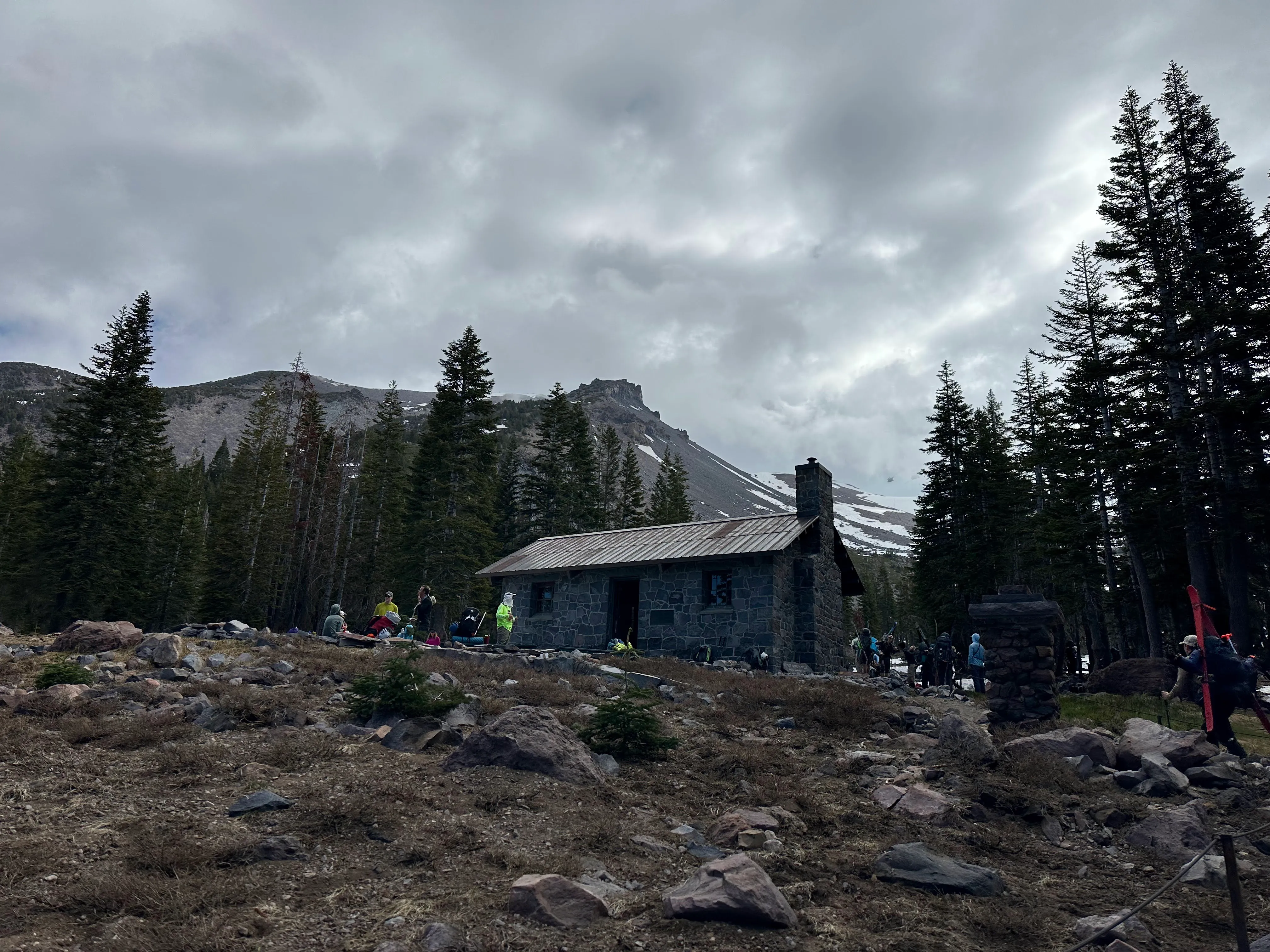
We arrived to Helen Lake to find it crowded, even with our early start. It was a full on “tent city” with a lot of ambitious mountaineers out celebrating the holiday weekend in style.
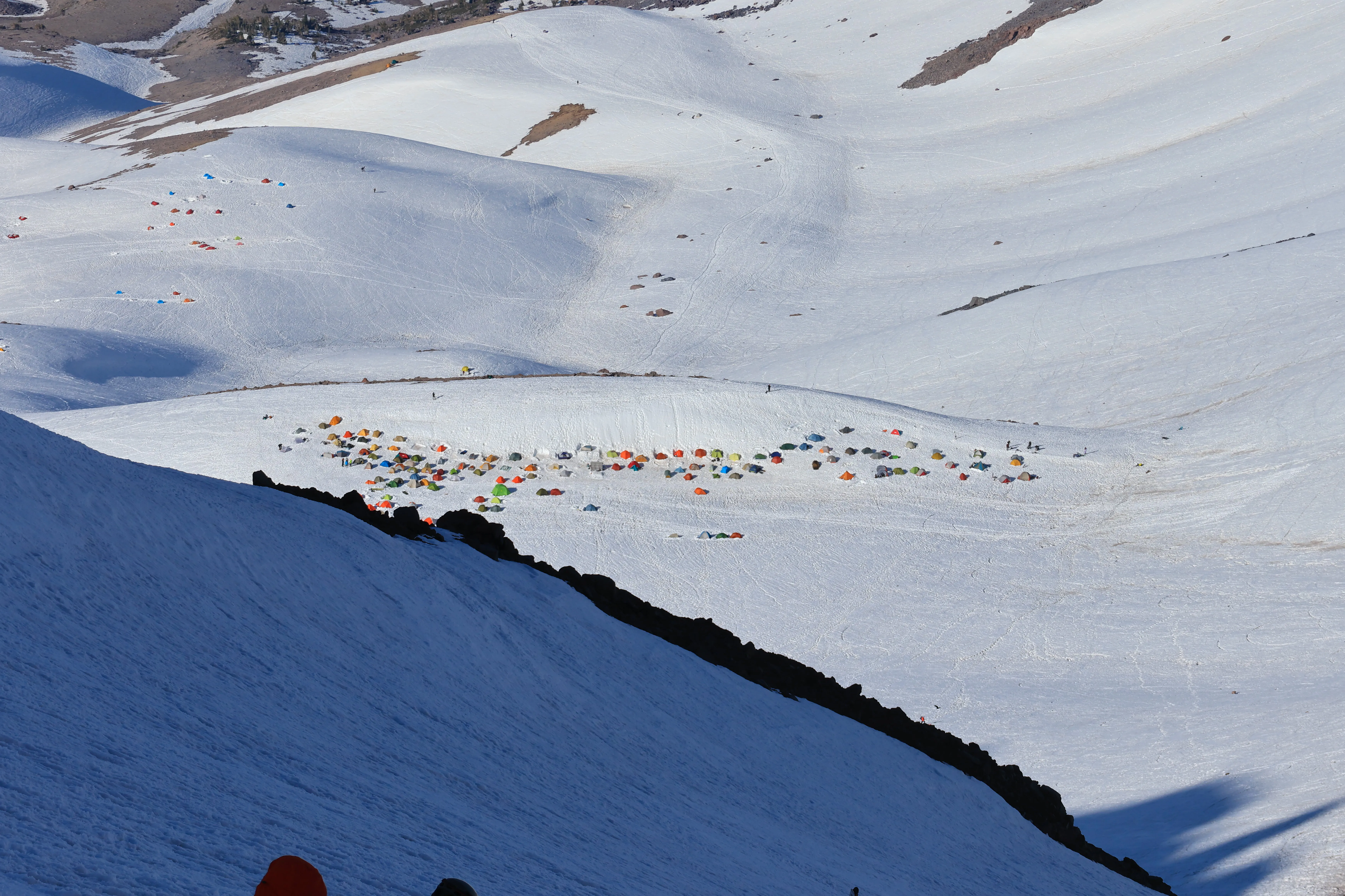 Tent city at Helen Lake
The group dug in where we could and set up camp. The privacy pit was in rough condition and severely declined as the weekend went on. Even after a complimentary clean-out and deeper dig in! Be prepared to witness some trace.
Leaders decided on a 1am start time. The team worked like pros setting up a common area and boiling water. We were well supplied thanks to the hard work of the water crew. Melting snow at high camp is a must!
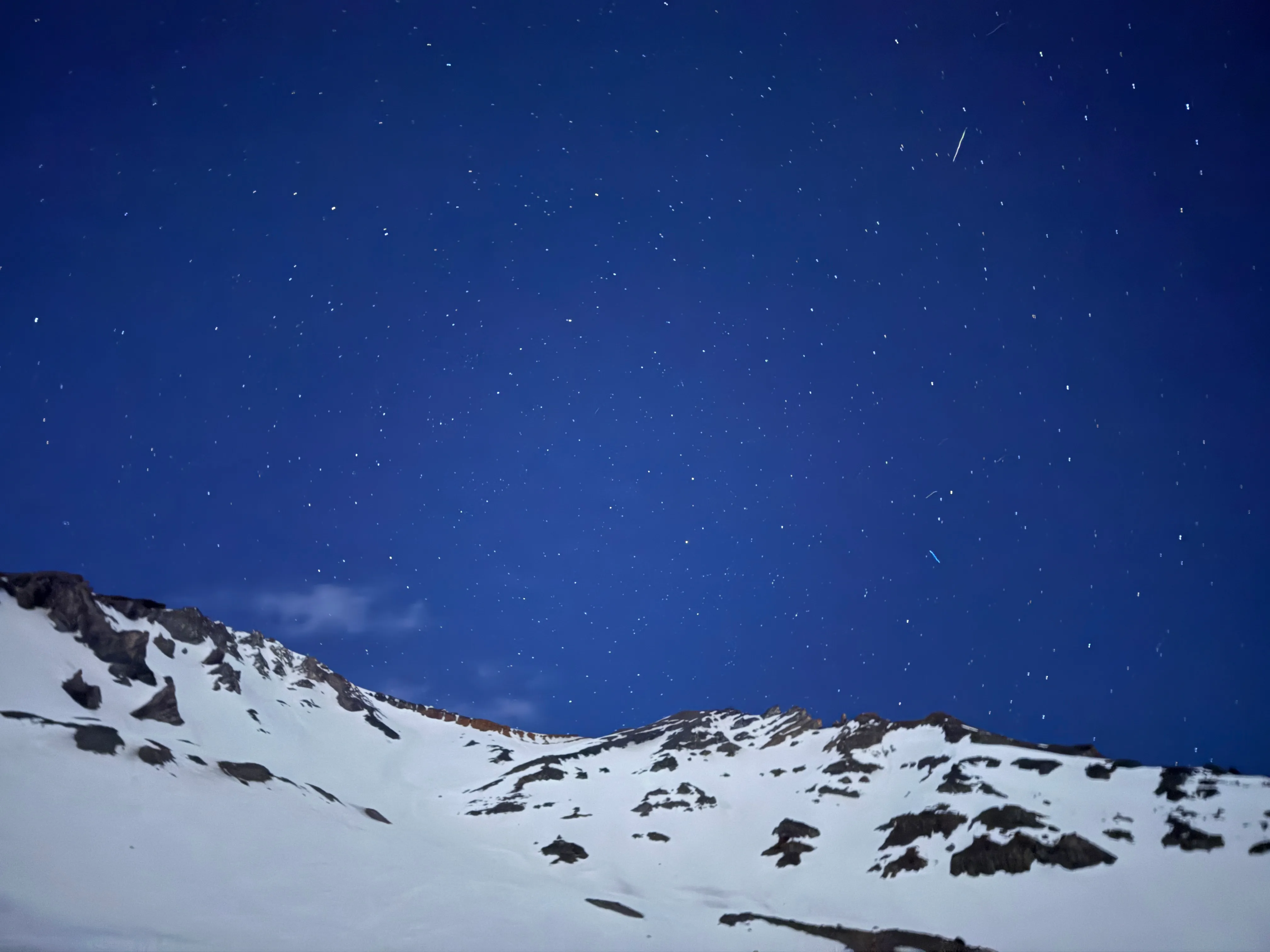 A starry night to begin our ascent
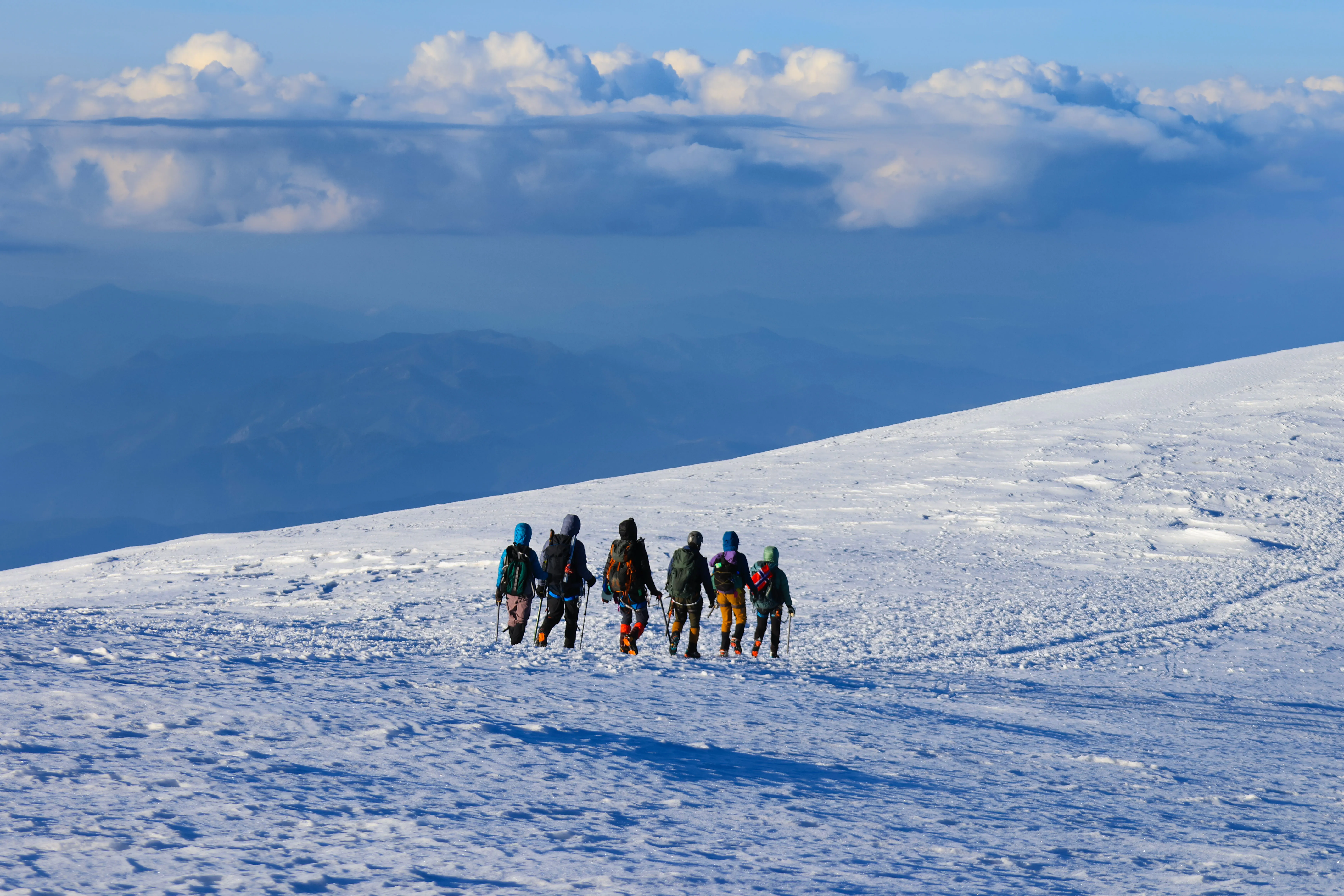
One small group headed up an hour earlier as they anticipated a slower pace. Everyone was on time to leave and we were on the snow by 0115 walking up (wonderful!). The snow was soft and exhausting until we hit around 11,000 ft, then we started to find our groove. Route finding was difficult. Where I couldn’t find a boot path, I led us back and forth on switchbacks until I spotted one again.
Eventually we found our stairway to Red Banks and took a snack break. There is no privacy here, but it is a popular spot for people (like me) to get hit with GI distress (13,000+ ft), so the group (and others we witnessed on the descent) had to wait a few extra minutes on the coldest bio break of my life (previous record was on Mount Baker during a snow storm). Thanks team!
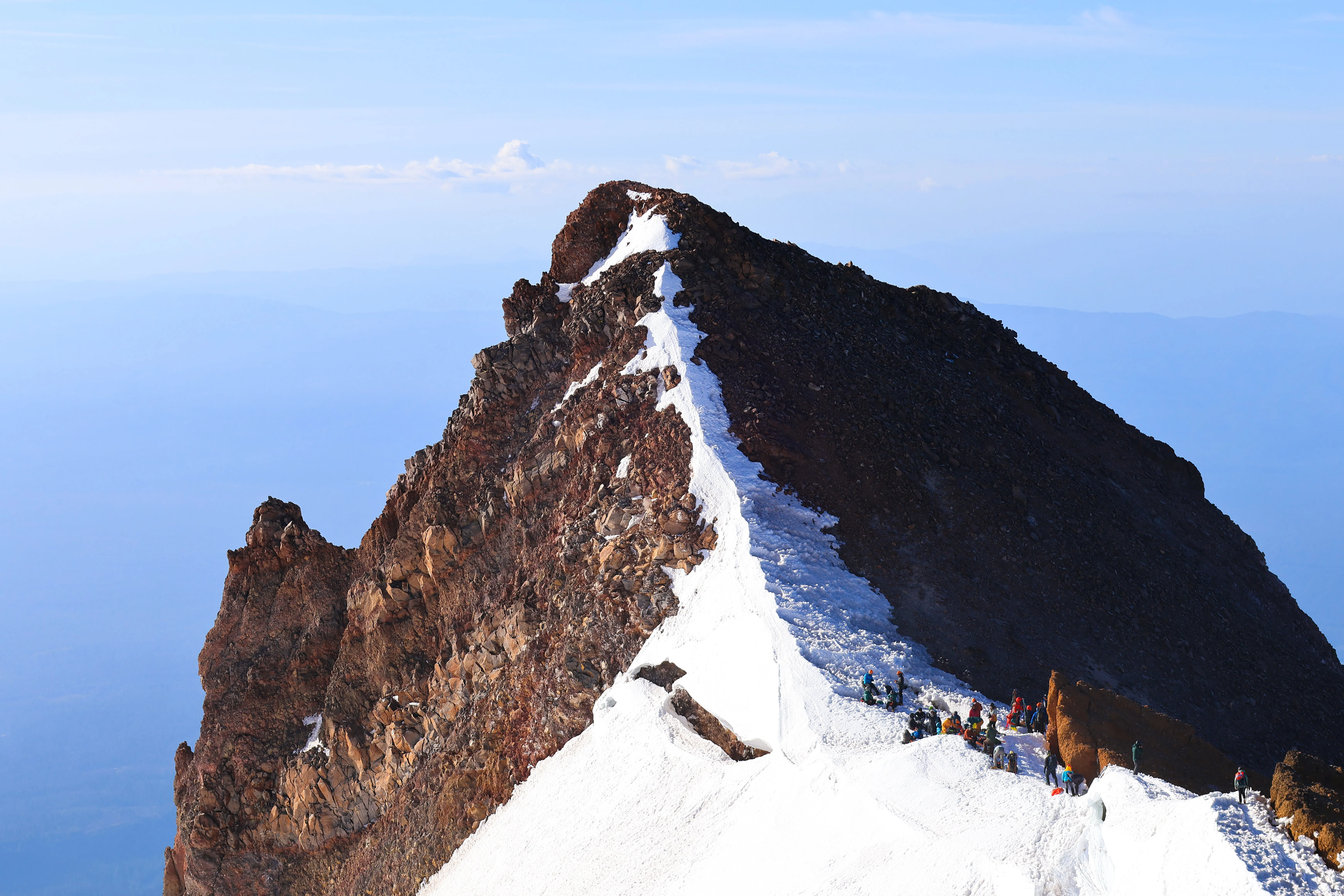 Team looking down at the Red Banks traverse
The small forward team turned around due to altitude sickness and returned to high camp as we approached Red Banks. Two in the larger group fell back due to altitude sickness and fatigue with another leader. The leaders coordinated through radios and adapted to the ever-changing situation. The conditions continuously changed on the mountain as well. Starting off with clear, starry skies, the weather quickly turned into gusty winds and clouds charging through as we climbed with low visibility on Misery Hill.
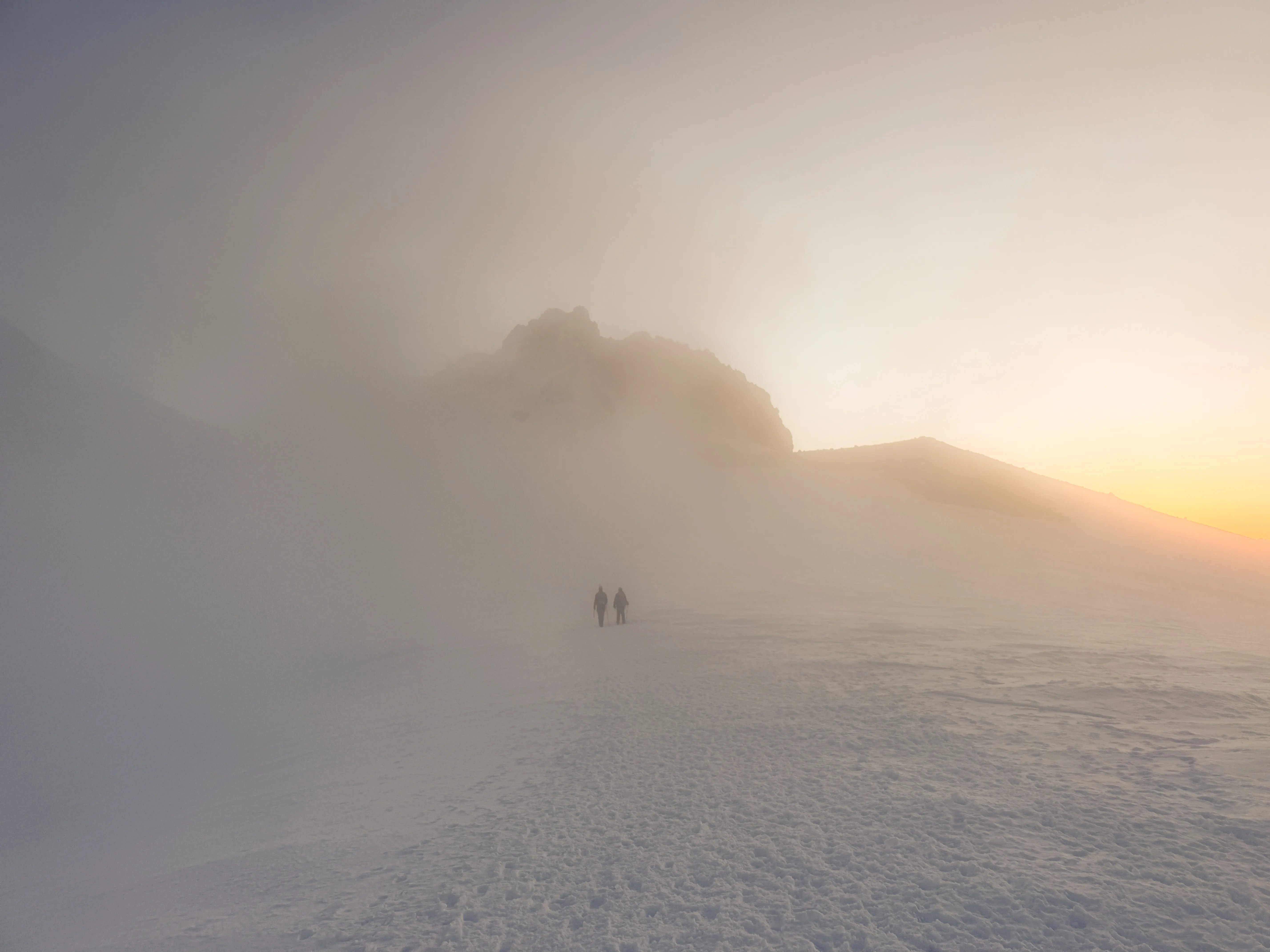 Misery Hill in the clouds
As a first timer on this mountain, I wasn’t sure what was ahead of us. Some of the group thought we should take crampons off, as misery hill is almost completely melted out. After a quick group discussion, we opted we keep them on. We were approaching 14,000 ft, and I was starting to get tired just reaching for my water bottle. I thought crampons on/off might end up being a huge delay for the seven of us, or wear some people out. We powered through. To our delight, the path is mostly sandy, loose dirt switchbacks. It was chill on the crampons.
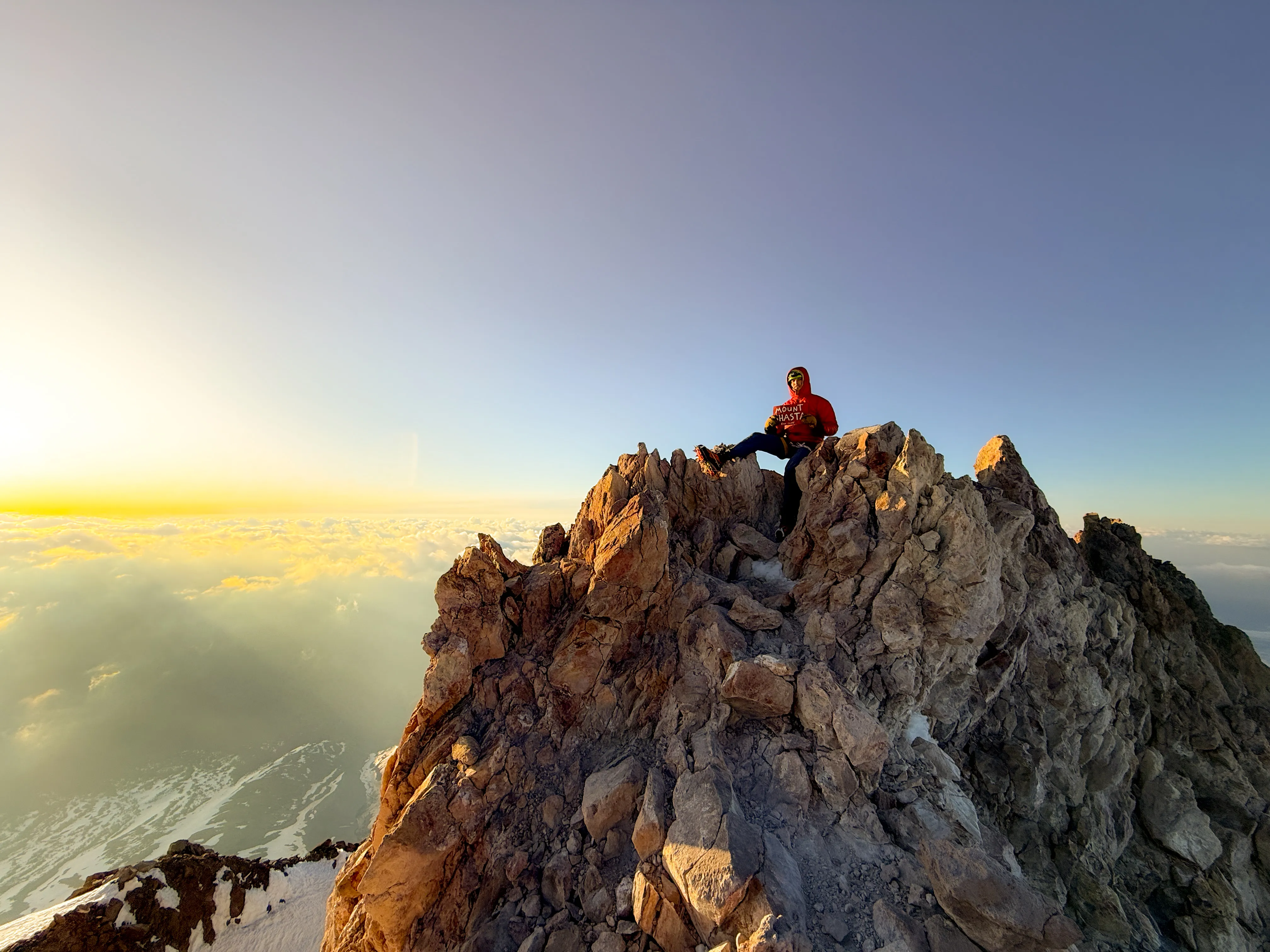
Near the top of Misery Hill, a cloud swallowed us whole. The light began to crest over the cloud ceiling. There was a faint, orange glow. The silhouette of the summit block appeared. Now we knew we were close. We expected a big dip, but it was a flat snowfield crossing over to the snowy boulder scramble.
 Summit block sunrise
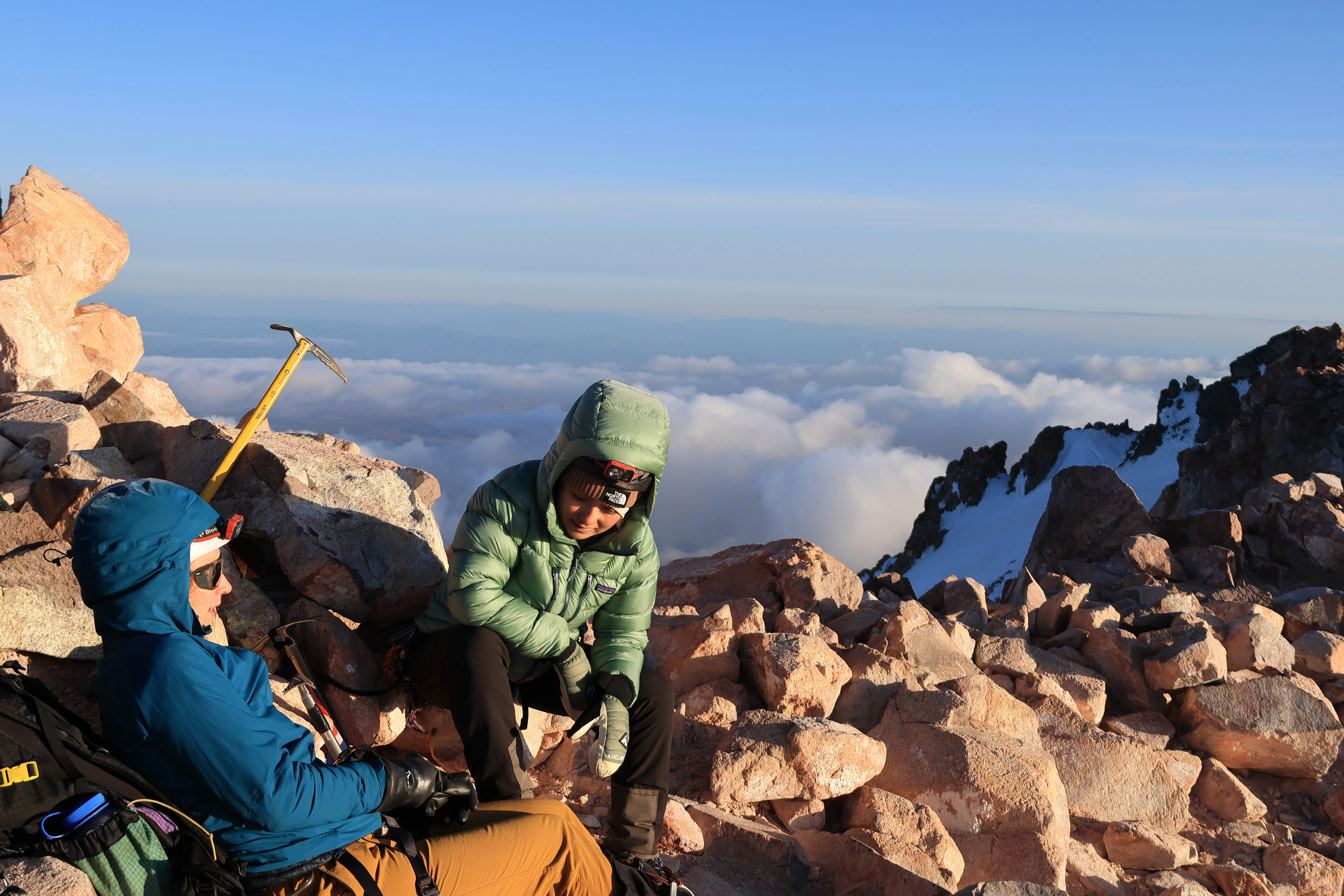
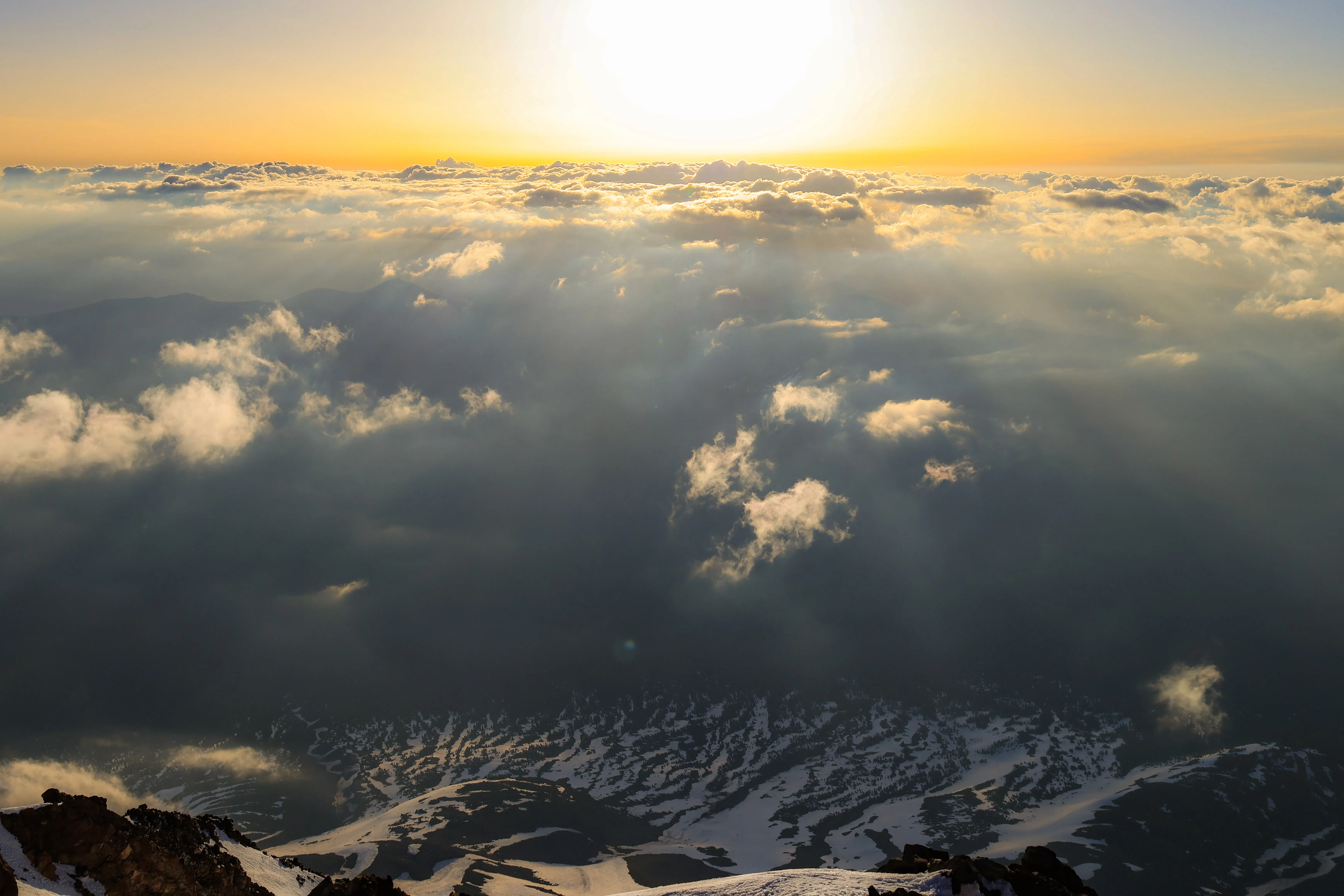
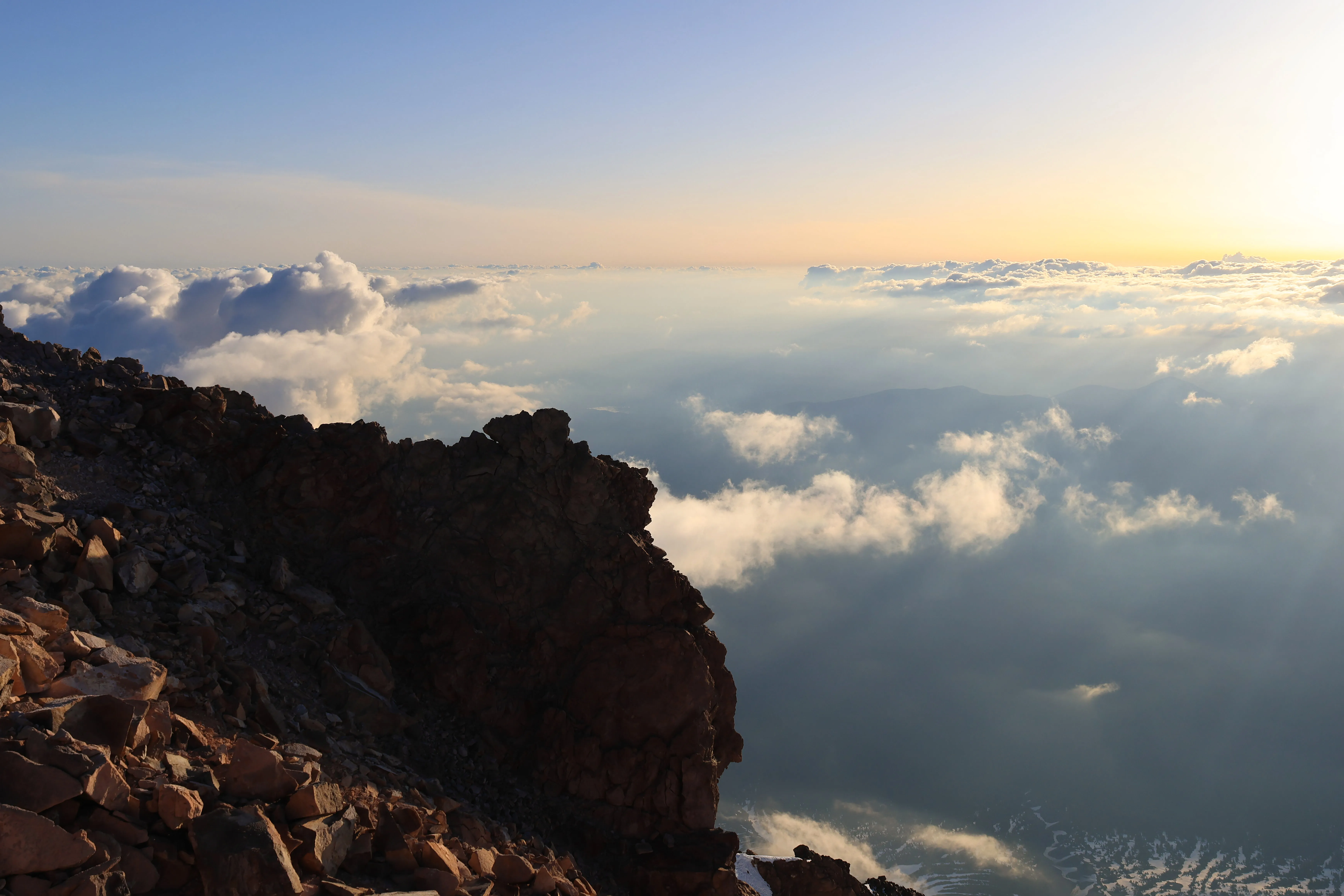
The team successfully summited at the precise moment the sunrise moved above the clouds. The Spring conditions yielded an incredible cloud inversion surrounding us. We celebrated and took a much-needed rest at 14,179 ft. Humbly, our team of seven were first to the summit register this day at about 0545!
 Cloud inversion at the summit
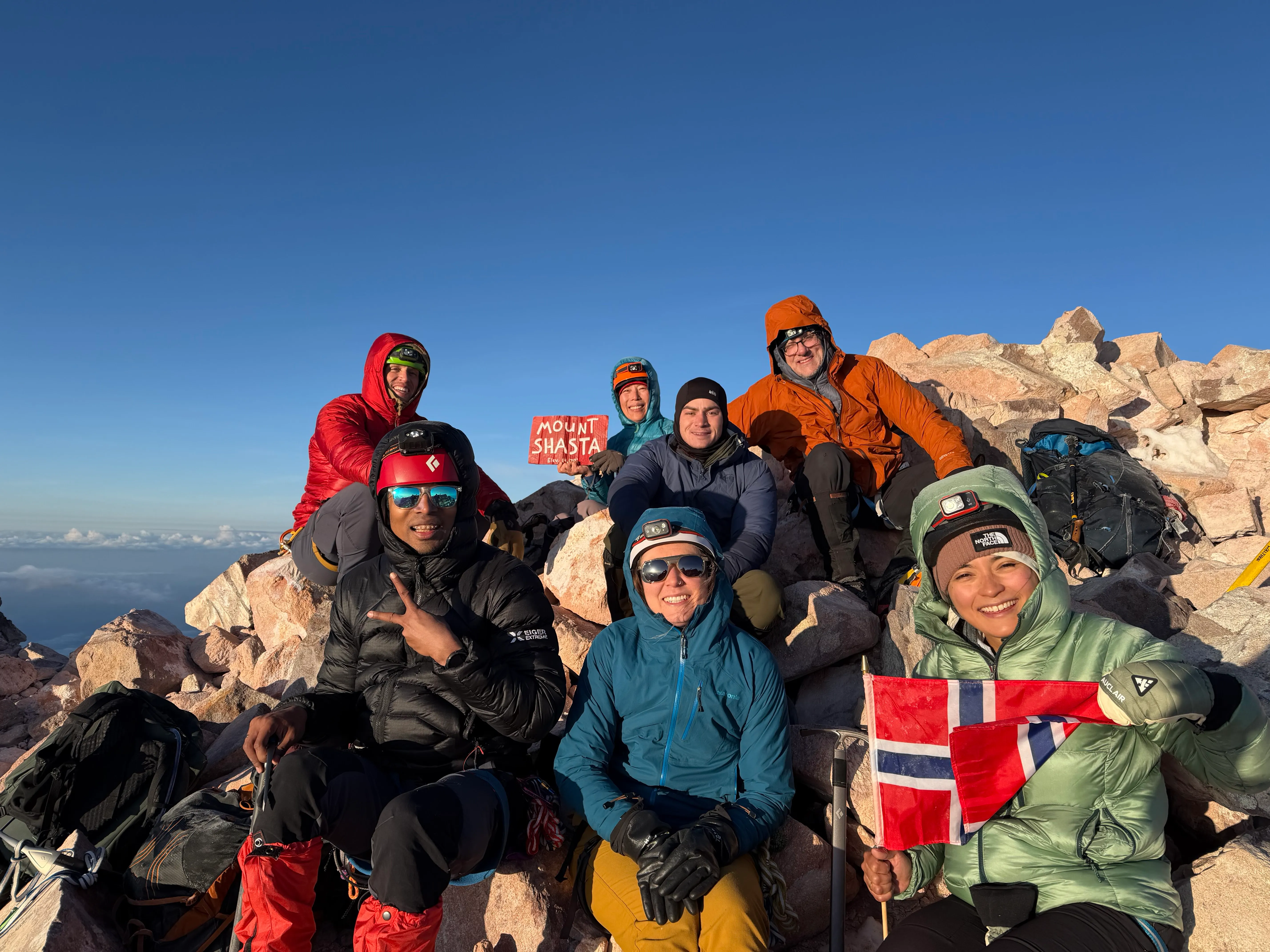 The team of seven — first to the register
 Resting at 14,179 ft
On our descent, we ran into our smaller team below that was taking it slow. Despite challenges, both pushed through and summited with their leader. An absolutely legendary effort against the odds! For us, the descent was icy and firm still. We kept crampons on and made our way down Avalanche Gulch. Misery Hill and Red Banks had turned into common social areas. Super cool that so many people were getting after it on a long weekend. Love to see it.
 Light rays on Shasta
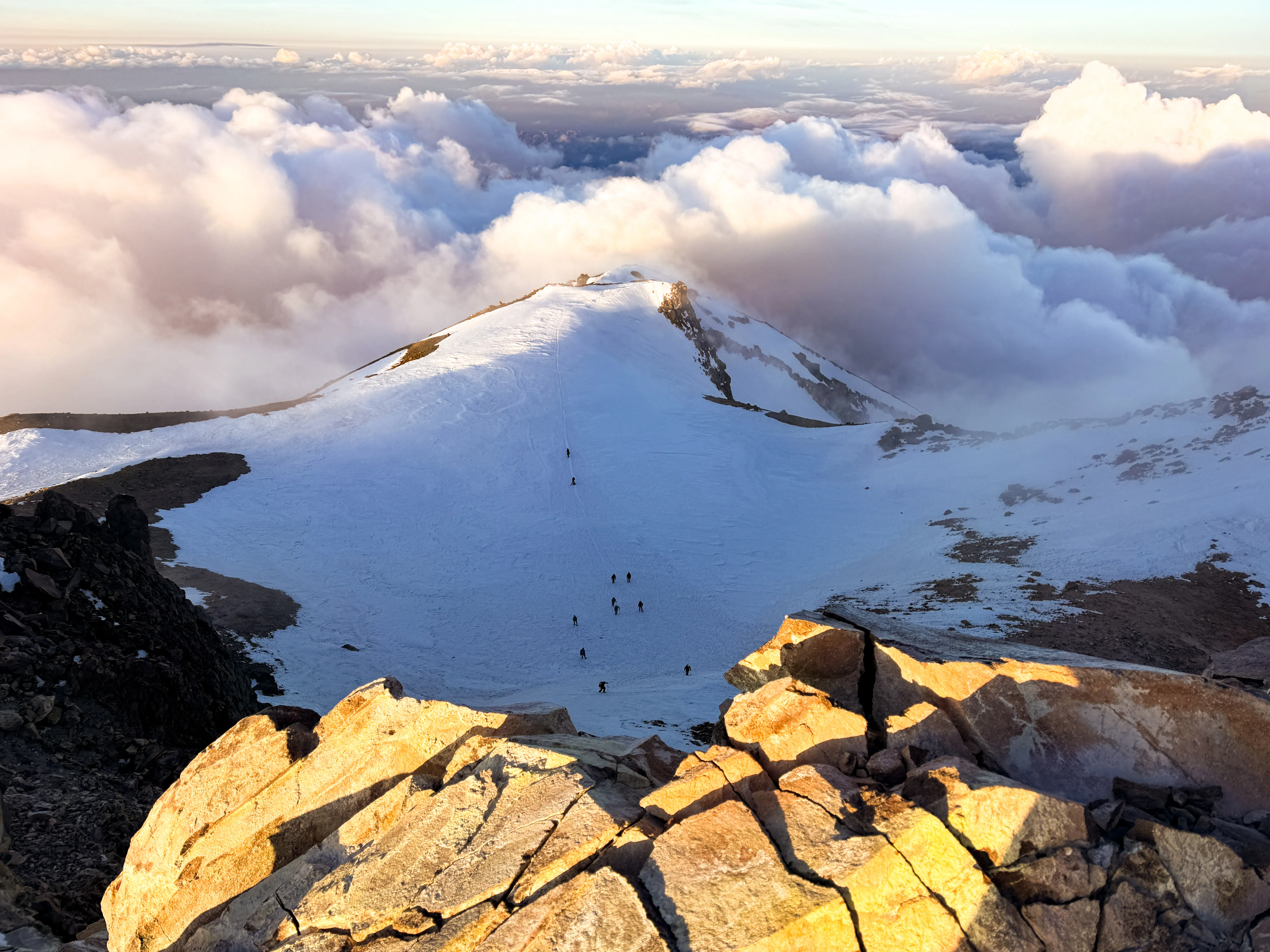
 Descending Misery Hill
We returned to High Camp greeted by the smaller forward team and rested up. We cleaned up camp, waited for the slower small team that summited to make it back down safely, and returned to the trail head. The snow down below Helen Lake was quite soft and punchy, so try your best to stay on whatever boot path is there.
The descent and return to TH is very fast. It was too icy to glissade from Red Banks. Once we hit some slightly softer snow in the sun, we sent it. We made it back around noon with an hour break at high camp.
Fortunate to meet a lot of epic people on this trip. It was a great mountain, the conditions were spectacular, and the team was amazing. Highly recommend if you’re keen on Cascade volcano climbs! All pictures by me unless noted. Follow me @journeywithjoshua_ on Instagram for all my adventures.
Mount Shasta Gear Loadout
Affiliate links, I may earn a commission, never at extra cost to you.
Carry & Move
-
Osprey
Atmos 65L
My do-everything pack. Carries heavy loads comfortably, ventilated back panel. Use it for most activities.
$300 -
Osprey
Archeon Chest Rig
Quick-access chest pack for phone, snacks, sunscreen. Keeps essentials off the hip belt.
$50 -
Scarpa
Mont Blanc Pro GTX
Stiff enough for front-pointing, light enough for 5000ft approaches. My go-to mountaineering boot.
$550 -
Mount to Coast
T1 Trail Shoe
My ultra trail shoes, doubled as approach shoes to the snowline. Light and comfortable for the hike in before boots go on.
-
Leki
Ultratrail FX.One Superlite (130cm)
The poles I run ultras with. Carbon and featherweight, and since they are my only pair right now they pull double duty on every hike too.
Climbing & Snow
-
Grivel
74cm Straight Shaft Ice Axe
Classic glacier travel axe. Self-arrest, probe, anchor — the do-everything tool for moderate terrain.
$120 -
Petzl
Vasak
Solid 12-point steel crampons. Reliable on glacier and moderate ice — the workhorse of my rack.
$175 -
Black Diamond
Vapor Helmet
Ultralight, great ventilation, fits over a beanie. The green one.
$100 -
Arc'teryx
AR-395a Harness
All-around alpine harness. Light for glacier travel, enough gear loops for a trad rack when needed.
$200 -
Sterling
Alpine Accessory Cord 6mm
The 6mm cord I bring on alpine missions for anchors and improvised systems. Lives in the pack on glaciated terrain.
$20 -
Mammut
Contact Sling 8.0 (180cm)
Two 180cm Contact slings for anchors and extending placements. Light, simple, always useful.
$15 -
Mammut
Sender Wire 60cm Quickdraw
Two long wiregate draws for the odd bit of protection. Light enough to forget they are in the pack.
$25 -
Petzl
Rocha Screw Lock Carabiner
Simple screw-gate locker. Reliable for glacier travel anchors and cordelette setups.
$14 -
Black Diamond
RockLock Screwgate Carabiner
My everyday screwgate locker. Big smooth gate, easy to work with gloves on.
$15
Layers & Apparel
-
Black Diamond
Soloist Finger Mitt
Split-finger mitt that trades a little dexterity for real warmth. My hand layer on Shasta, plenty warm up high without going full expedition mitt.
$160 -
Outdoor Research
Helium Hoodie
Packable puffy for breaks and the summit. Throw it on the moment you stop moving and the wind finds you.
$280 -
Himali
Monsoon Shell
Alpine shell — waterproof, breathable, pit zips. Handles Pacific NW rain and summit wind equally.
$400 -
Outdoor Research
Cirque Lite Softshell Pants
Stretchy softshell pants for approaches and moderate alpine climbing. Move well, dry fast.
$120 -
Mammut
Selun FL Sun Hoody
UPF sun protection that breathes on long glacier days. Hood up, sleeves down, no sunscreen needed on arms.
$80 -
Arc'teryx
Grotto Toque
Warm toque for cold starts and summit wind. Fits under a helmet.
$40 -
Arc'teryx
Aerios 5-Panel Cap
Breathable cap that keeps the sun off on long snow days and dries fast.
$40 -
Generic
Sun Balaclava
UPF balaclava for glacier days. Full face coverage without suffocating.
$35 -
Badger
SPF 50 Sunscreen
Mineral zinc sunscreen — thick, stays put on sweaty glacier days. Reef safe too.
$16 -
Vallon
Heron Glacier Glasses
Side shields, category 4 lenses. Essential for high-altitude snow travel — no snow blindness.
$150
Electronics
-
Black Diamond
Storm 450
My alpine-start headlamp, bright enough to route find on snow in the dark. Ran it from the 1am start to sunrise on Shasta without a thought.
-
Rocky Talkie
Mountain Radio
Carried a pair for team comms on the mountain. Glove-friendly, leashed so they do not drop, and they just work when the team is spread across a slope.
$110 -
Garmin
inReach Mini 2
Satellite messaging and an SOS button for where there is no signal, which is most of the time up high. Non-negotiable safety kit.
$400
Camera
-
Canon
EOS R7
The hero camera for stills. Crop sensor keeps the kit light for long days; reach is great for wildlife.
$1,499 -
Canon
RF 24-105mm f/4-7.1 IS STM
Versatile walk-around lens. Light, stabilized, covers wide to portrait. My most-used lens on trail.
$400
Shelter & Sleep
-
REI Co-op
Half Dome 2 SL+
Roomy, freestanding, handles PNW rain. Not ultralight but livable for multi-day trips.
$350 -
Mountain Equipment
Glacier 700 Sleeping Bag
Down bag rated for alpine camps. Warm, packs small, handles cold bivy nights.
$400 -
Therm-a-Rest
NeoAir XLite
R-value 4.2 in a tiny package. The inflatable pad that actually keeps you warm at altitude.
$220 -
Exped
FlexMat (Z-Mat)
Closed-cell foam pad — bulletproof, no punctures, doubles as a sit pad. Pairs with the NeoAir for cold nights.
$50
Food & Water
-
Odoland
6pcs Camping Cookware Mess Kit
Cheap as hell and has worked forever. Pot, stove, spork, mesh bag. Switching to JetBoil soon but this got the job done.
$30 -
AlpineAire
Strawberry Granola with Milk
My alpine-start breakfast before the 1am push. Easy calories that go down early when nothing else sounds good.
$10 -
Katadyn
BeFree 1L Water Filter
1L squeeze filter for refills on the mountain. Fast flow, packs flat, freezing is its only real enemy.
$45